DuPont State Forest
DuPont State Recreational Forest
Forest Supervisor Jason Guidry
Forest Events & Announcements
Responsible Trail Use
Please respect the trail system by limiting your use during and after rain or snow events. DuPont State Recreational Forest (DSRF) is part of a temperate rain forest where average amounts of rainfall can exceed 80 inches annually. At any time during and after inclement weather, the trails at DSRF may become muddy and susceptible to irreversible damage by biking, equestrian, and hiking. When trails become muddy, please practice responsible trail use by riding graveled forest roads instead of trails. Closures could occur if damage is observed by the Ranger Staff. For current conditions, please call: 828-877-6527 ext. 105.
DSRF Visitor Survey: Help us plan for the future and tell us about your experience. By taking a few minutes to complete this survey, you will help us better understand and plan for the needs of visitors participating in outdoor recreational activities at DSRF.Hours of Operation:
The forest is open regular hours from 5 a.m. to 10 p.m. daily. The Visitor Center is open from 9 a.m. to 5 p.m. daily.
NOTICE: Trail Closures at DSRF
In response to predicted heavy snow accumulation, officials at DuPont State Recreational Forest (DSRF) will close single track trails on Sunday, December 9. Large amounts of snow will create conditions that make many of the Forest trails susceptible to damage from trail users. More Information
Trail Etiquette:
Please use proper trail etiquette no matter what activity you are engaged in. Maintain a prudent speed, make others aware of your presence, and don't let your activities put others in danger. We want everyone to have an enjoyable, and most importantly, safe visit to the forest.
Location
View Larger Map
The 10,400 acre DuPont State Recreational Forest is located in Henderson and Transylvania Counties between the towns of Hendersonville and Brevard.
To reach the forest from Asheville, take I-26 east toward the Asheville Airport. Exit at the Airport (exit 40) and head south on NC-280 for about 16 miles. Turn left onto US -64 (heading east) for about 4 miles. In Penrose, turn right onto Crab Creek Road for about 4 miles to DuPont Road. Turn right on DuPont Road and continue for 3.1 miles.
To reach the forest from Brevard, take US 276 south to Cedar Mountain and turn left on Cascade Lake Road. Continue on Cascade Lake road for 2.5 miles, then turn right on Staton Road/DuPont Road. Continue on Staton Road/DuPont Road for 1.5 miles until you reach the High Falls access area.
To reach the forest from Hendersonville, take US 25 Business (Church Street) south to Kanuga Road. Turn right on Kanuga Road, which becomes Crab Creek Road, and go 11 miles. Turn left on DuPont Road and continue for 3.1 miles.
For internet mapping or turn-by-turn GPS, enter the intersection of Crab Creek Road and DuPont Road. From there, head South on DuPont Road for 4 miles until you reach the High Falls access area.
Land & Resource Management Plan
The intent of the DuPont State Recreational Forest Land and Resource Management Plan is to provide the ecological context within which management will be conducted on the forest, to describe the desired future condition of natural resources throughout the forest toward which management will be directed, and to outline appropriate management techniques to work towards those conditions. The goals and objectives presented in this plan were developed to support other statewide initiatives regarding natural resource conservation and education.
Questions or comments regarding the plan can be directed to management forester Michael Sweat.
- DuPont State Forest Land & Resource Managment Plan
- Appendix A: Crosswalk
- Appendix B: Historical Overview
- Appendix C1: Map of Natural Communities
- Appendix C2: Map of Recreational Trails and Roads
- Appendix C3: Map of Dedicated Nature Preserve Areas
- Appendix C4: Map of Soil Types
- Appendix C5: Map of Water Resources and Topography
- Appendix D: Soil Types
Forest Information
Forest Rules (PDF)*Updated June 2018*Picnic Shelter Reservations (PDF)
Obtaining a Vehicle Permit for Persons with Disabilities (PDF)
Gameland Hunting Dates (PDF)
Weather Station Data
Commercial Use
To manage increased visitation to the forest and to protect visitor safety and natural resources, DSRF is now issuing commercial use permits. State Forest administrative rule 02 NCAC 60B .1021states, "No person shall, while in or on an Educational State Forest or State Forest, sell or offer for sale, hire or lease, any object or merchandise, property, privilege, service or any other thing, or engage in any business except under permit and at such places and for such periods as may be designated." Commercial use permits and fees are explained in the attached DSRF commercial use policy.
If you plan to use DSRF for your business you will need to complete and return the attached permit application. You may respond by e-mail (preferred) or you can send a hard copy of the application. We will use this information to prepare the permit and send it to you for a signature. Wait until you receive the permit to send payment of permit fees.
Call 828-877-6527 or e-mail the forest office if you have any questions.
Policy (PDF)Application for Commercial Use (PDF)
**Please be advised that there is a minimum 30 day review period for all Commercial Use and Special Use permit applications.
Medical Plan (PDF)
Maps
Vicinity Map (PDF, 8.5 x 11)
Trails Map (PDF, 11 x 17)
Waterfalls Map (PNG, 8.5 x 11)
Photos
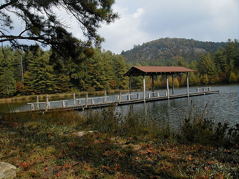
Lake Dense.
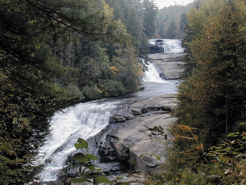
Triple Falls.
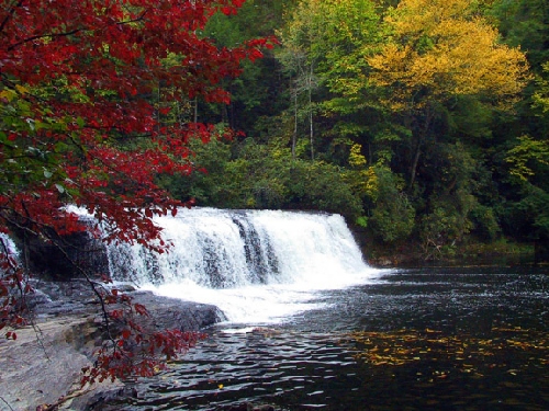
Hooker Falls.
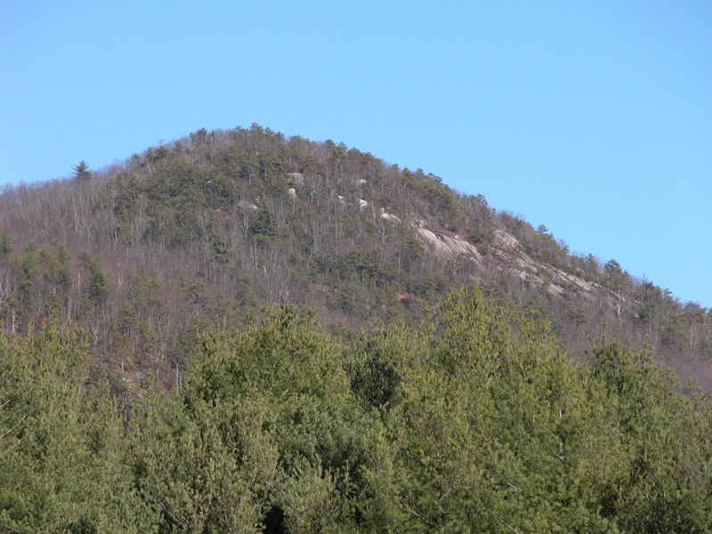
Stone Mountain.
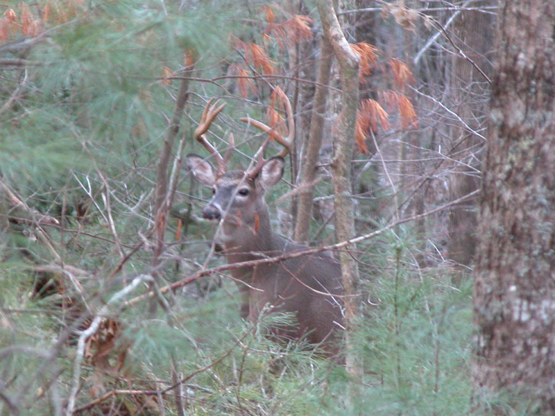
Management is conducted for many species of wildlife at the forest, including deer such as this buck.
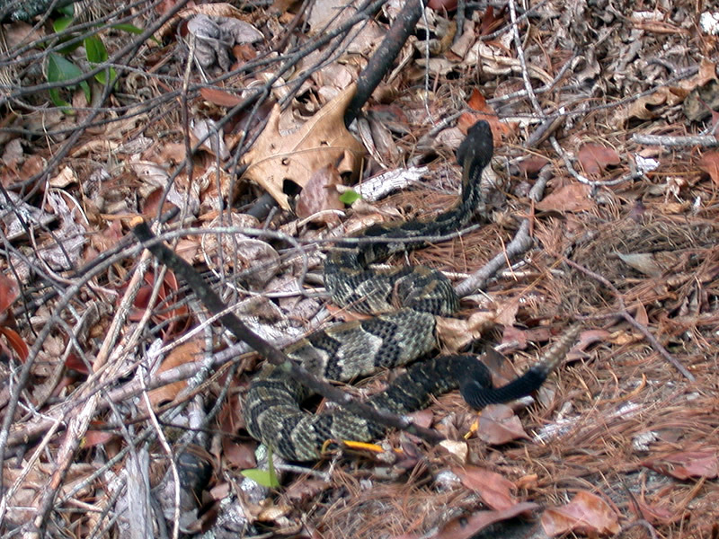
A rattlesnake is one of the natural hazards in the forest visitors should be aware of.
Contact Information
Telephone:
Email:
PO Box 300
Cedar Mountain, NC 28718-0300
Voice: 828-877-6527
Fax: 828-862-8531
Permits and reservations: 828-877-6527, ext. 242
dupontsf.ncfs@ncagr.gov